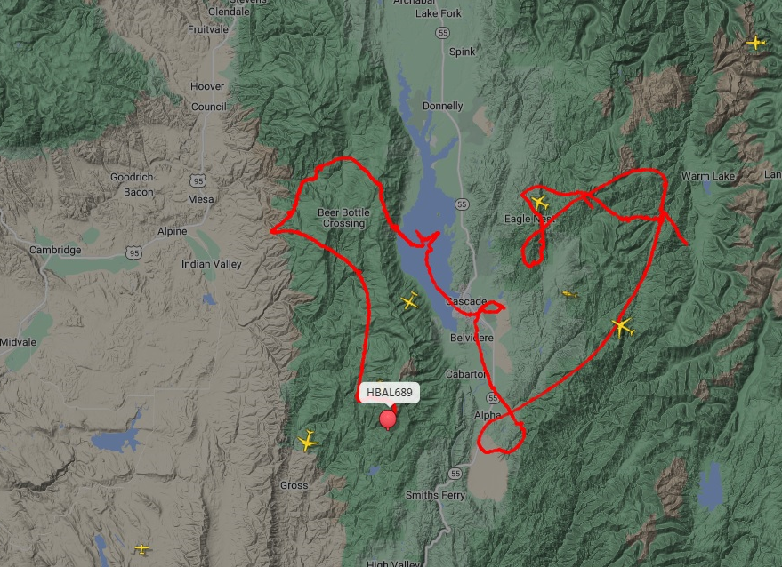
What kind of $#@&% balloon does this?

The #1 community for Gun Owners in Indiana

Member Benefits:

  • Fewer Ads!
  • Discuss all aspects of firearm ownership
  • Discuss anti-gun legislation
  • Buy, sell, and trade in the classified section
  • Chat with Local gun shops, ranges, trainers & other businesses
  • Discover free outdoor shooting areas
  • View up to date on firearm-related events
  • Share photos & video with other members
  • ...and so much more!
  • Lmo1131

    Sharpshooter
    Rating - 0%
    0   0   0
    Jan 11, 2020
    594
    93
    east of the Pacific
    I just discovered a cool website; www.FlightRadar24.com You can track any aircraft, in real time anywhere on the planet by tail number, flight number, or location. Yesterday we had a low flying helicopter tracking back and forth over our county all day and I was looking for information on it. Turns out it contracted by SoCal Gas Co to sniff for methane gas leaks in their distribution system using green Lidar.

    1723838669699.png

    But while I was looking to see where it might be today I discovered something interesting; high altitude Helium Balloons operating up to 63,000' and being steered.

    1723838835062.png

    These flight paths are typical of all of them. The one below V is the one at the far left of the image above.

    1723839005943.png

    This one near Sioux City
    1723839084828.png

    Here is a discussion fron 2022 that mentions them > https://forums.radioreference.com/threads/hot-air-balloon-at-60-000-ft-in-north-carolina.442351/

    And here is a link to what they are, and who makes them. But nothing about what they are doing... https://aerostar.com/products/balloons-airships

    Turns out they operate in "constellations" of two or more, and are used to track thunderstorms... or so they say.

    1723839427579.png
     

    Attachments

    • 1723838896521.png
      1723838896521.png
      1,013 KB · Views: 2

    foszoe

    Grandmaster
    Site Supporter
    Rating - 100%
    24   0   0
    Jun 2, 2011
    17,611
    113
    Geez. And I was just happy with my telescope, binoculars, and camera. Now i gotta worry about 737s coming out of the sky....and it ain't so CCR song.
     

    firecadet613

    Master
    Rating - 100%
    40   0   1
    Dec 24, 2012
    3,302
    113
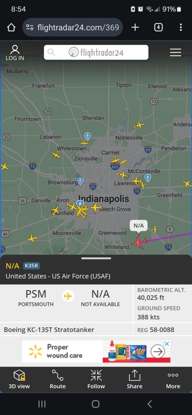
    I had flight tracker on my phone, military planes didn’t show up…
    They'll often show up on this, unless they've fully gone dark.


    I was out by Scott AFB a few weeks ago and a KC-135 doing touch and goes only showed up on this.
     

    jsx1043

    Grandmaster
    Rating - 100%
    52   0   0
    Apr 9, 2008
    5,142
    113
    Napghanistan
    That's some good information. Those are normal ISR balloons. The first trace seems to be a mapping flight.
    I listen to https://monkeywerxus.com/ and he gives good information on flight traffic.
    MonkeyWerx is THE place to go to learn all about how aircraft travel data can be extrapolated and interpreted to provide real time intelligence.

    I use FlightAware because I feel like I get more information for the free app than I do out of the free version of FlightRadar24, which pushes heavily to get you to subscribe. On the free versions, FlightAware will geolocate to your ping, whereas FR24 won’t and wants a subscription to unlock that feature. Most of the time I pop up the app quickly to see what’s flying above me because of some weird plane or helicopter without any markings making a weird search pattern. And to keep track of my daughter’s flights.

    I had this guy fly overhead the other day:

    IMG_7281.jpeg
     
    Last edited:
    • Like
    Reactions: Leo

    firecadet613

    Master
    Rating - 100%
    40   0   1
    Dec 24, 2012
    3,302
    113
    MonkeyWerx is THE place to go to learn all about how aircraft travel data can be extrapolated and interpreted to provide real time intelligence.

    I use FlightAware because I feel like I get more information for the free app than I do out of the free version of FlightRadar24, which pushes heavily to get you to subscribe. On the free versions, FlightAware will geolocate to your ping, whereas FR24 won’t and wants a subscription to unlock that feature. Most of the time I pop up the app quickly to see what’s flying above me because of some weird plane or helicopter without any markings making a weird search pattern. And to keep track of my daughter’s flights.

    I had this guy fly overhead the other day:

    View attachment 373778
    I'll have to try Flightaware's app (I've downloaded FR24s app, but use FAs website).

    FR24s app is a simple button push to zoom to your location on the free version. I prefer FR24 as it provides tail numbers.
     

    Twangbanger

    Grandmaster
    Rating - 100%
    21   0   0
    Oct 9, 2010
    7,136
    113
    Can you use these things to identify flights from past dates? A week or so ago, my garmin watch wigged out during a run, and when I downloaded my data, it showed my run path as going from Michigan to Puerto Rico in a straight line. (It congratulated me on my longest run and fastest mile :lmfao: ). I can only imagine it got me confused with the GPS transceiver on a plane that passed overhead (I was running right by an airport).
     

    OutdoorDad

    Master
    Rating - 100%
    1   0   0
    Apr 19, 2015
    2,126
    83
    Indianapolis
    I just discovered a cool website; www.FlightRadar24.com You can track any aircraft, in real time anywhere on the planet by tail number, flight number, or location. Yesterday we had a low flying helicopter tracking back and forth over our county all day and I was looking for information on it. Turns out it contracted by SoCal Gas Co to sniff for methane gas leaks in their distribution system using green Lidar.

    View attachment 373593

    But while I was looking to see where it might be today I discovered something interesting; high altitude Helium Balloons operating up to 63,000' and being steered.

    View attachment 373594

    These flight paths are typical of all of them. The one below V is the one at the far left of the image above.

    View attachment 373596

    This one near Sioux City
    View attachment 373597

    Here is a discussion fron 2022 that mentions them > https://forums.radioreference.com/threads/hot-air-balloon-at-60-000-ft-in-north-carolina.442351/

    And here is a link to what they are, and who makes them. But nothing about what they are doing... https://aerostar.com/products/balloons-airships

    Turns out they operate in "constellations" of two or more, and are used to track thunderstorms... or so they say.

    View attachment 373598
    you have a lock on Elon Musk?
     
    Top Bottom